Gankeng
Twenty-nine hectares of industrial land in a valley in northern Shenzhen, replanned as a place to work, live and visit — linked on foot to the Hakka town that gave it its name.
- Project
- Gankeng Ancient Town District Masterplan
- Location
- Longgang, Shenzhen, China
- Client
- OCT — Overseas Chinese Town, Shenzhen
- Year
- 2016
- Study area
- 28.7 ha, 13 plots
- Programme
- VR and technology industry, housing, hotel and serviced apartments, education, retail
- Status
- Land-use feasibility study
- Design
- Architecture Georges Hung
The question was never how much to build. It was where to put the height, and what to give back at the ground.
The brief
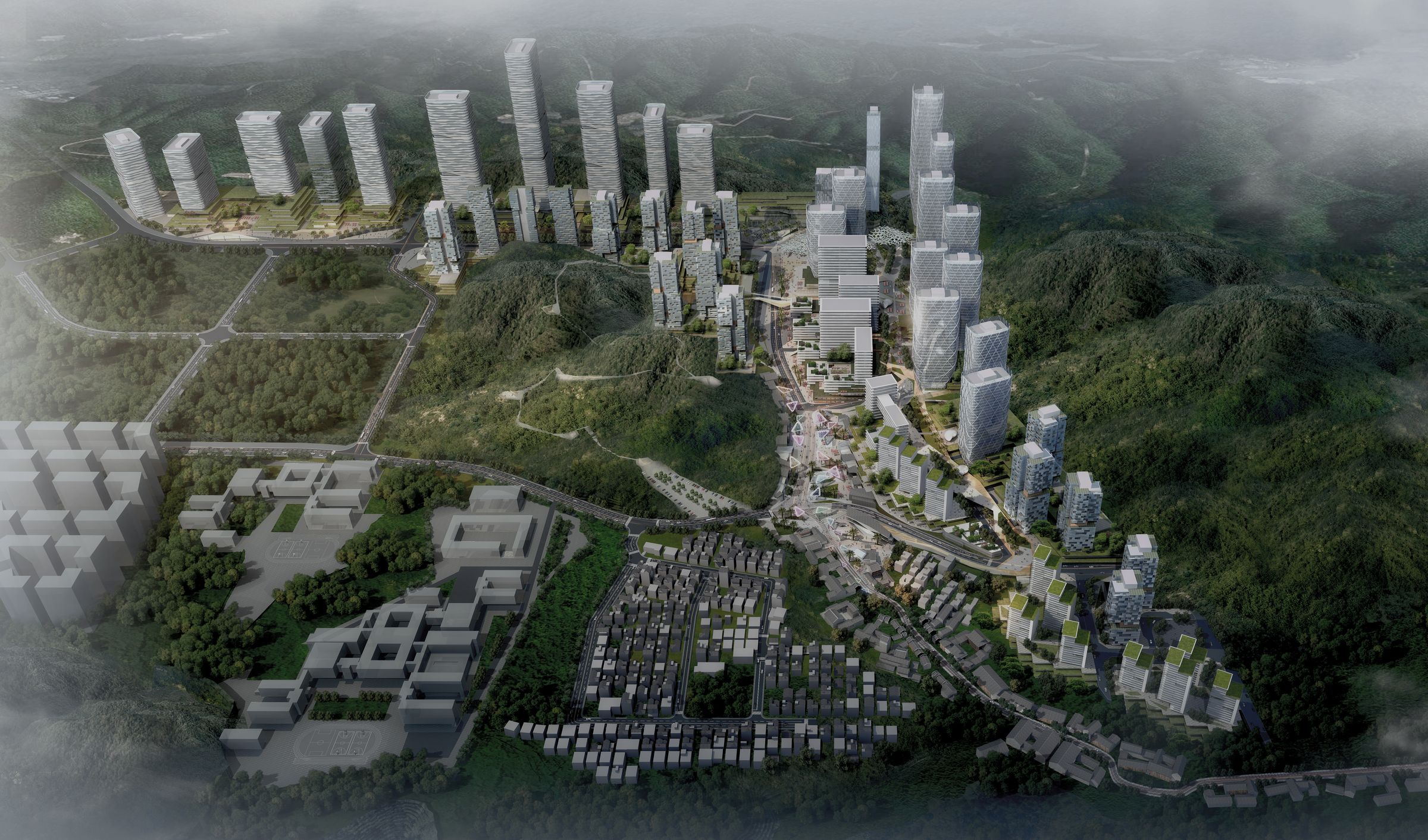
Gankeng sits at the end of a mountain ridge that sweeps across northern Shenzhen. Hills rise 110 metres around the valley. At its northern edge is Gankeng village, a Hakka settlement of walled courtyards, carved timber and craft. The rest of the valley was warehouses five to seven metres high, temporary sheds, empty apartment blocks and small vegetable plots.
The zoning gave 87% of the buildable land to industry, 11% to housing and 1.5% to commerce. The client wanted something else: a hub for the virtual-reality industry, with homes, schools and leisure, that would also bring visitors to the old town.
The tension
The floor area asked for could be met easily with towers. Spread evenly across the valley, they would have hidden the hills and dwarfed the village. The plan had to carry real density and still feel like a place shaped by its landscape.
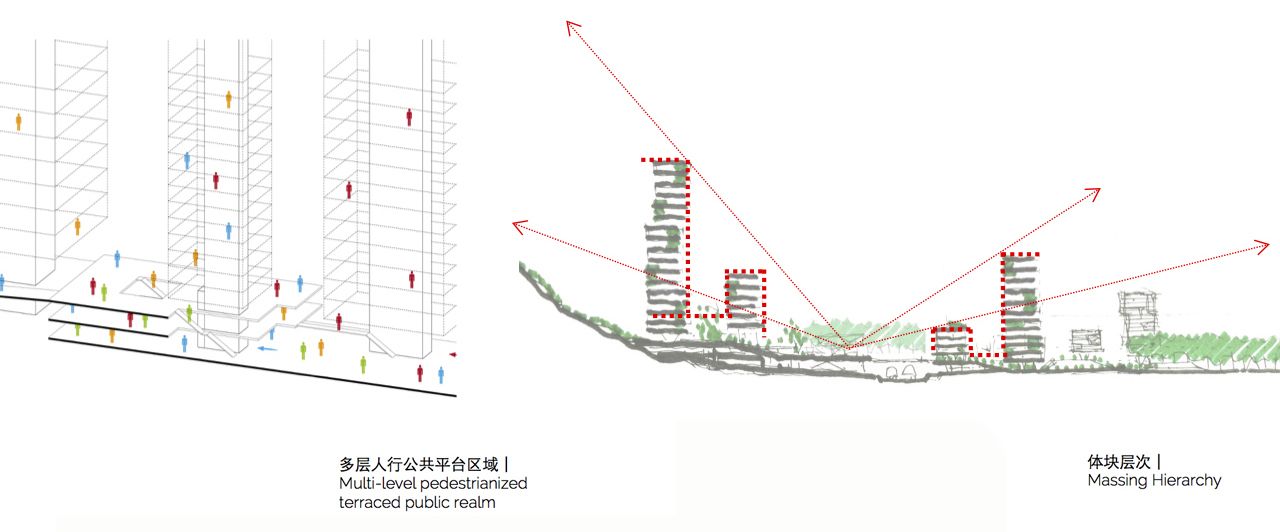
Put the height against the mountain. Give the valley floor to people.
The move
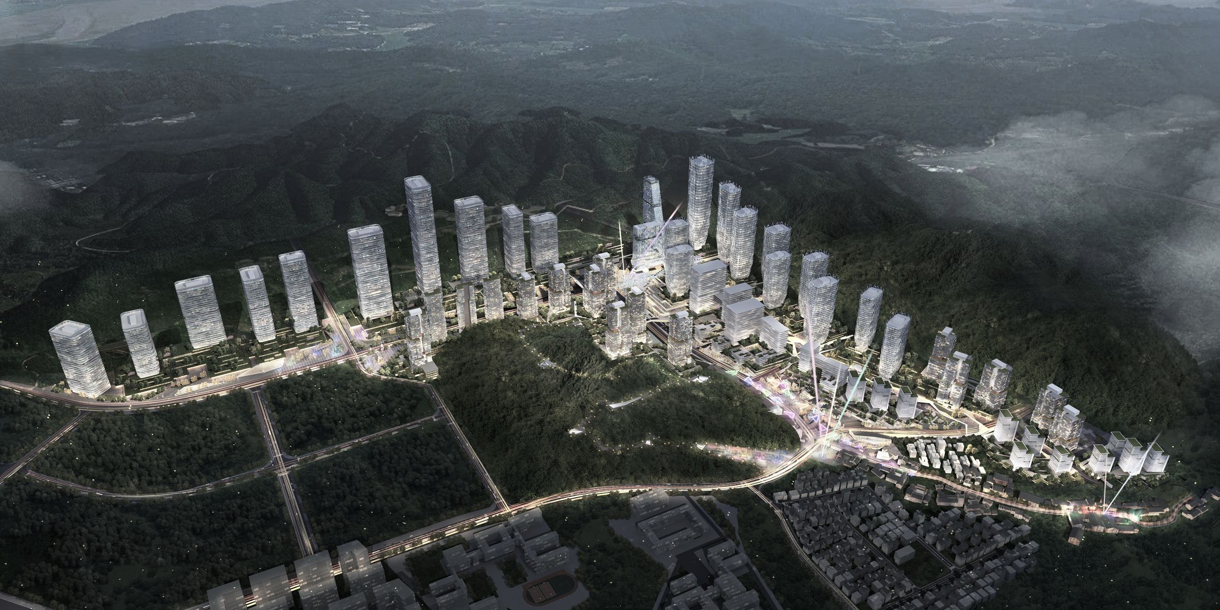
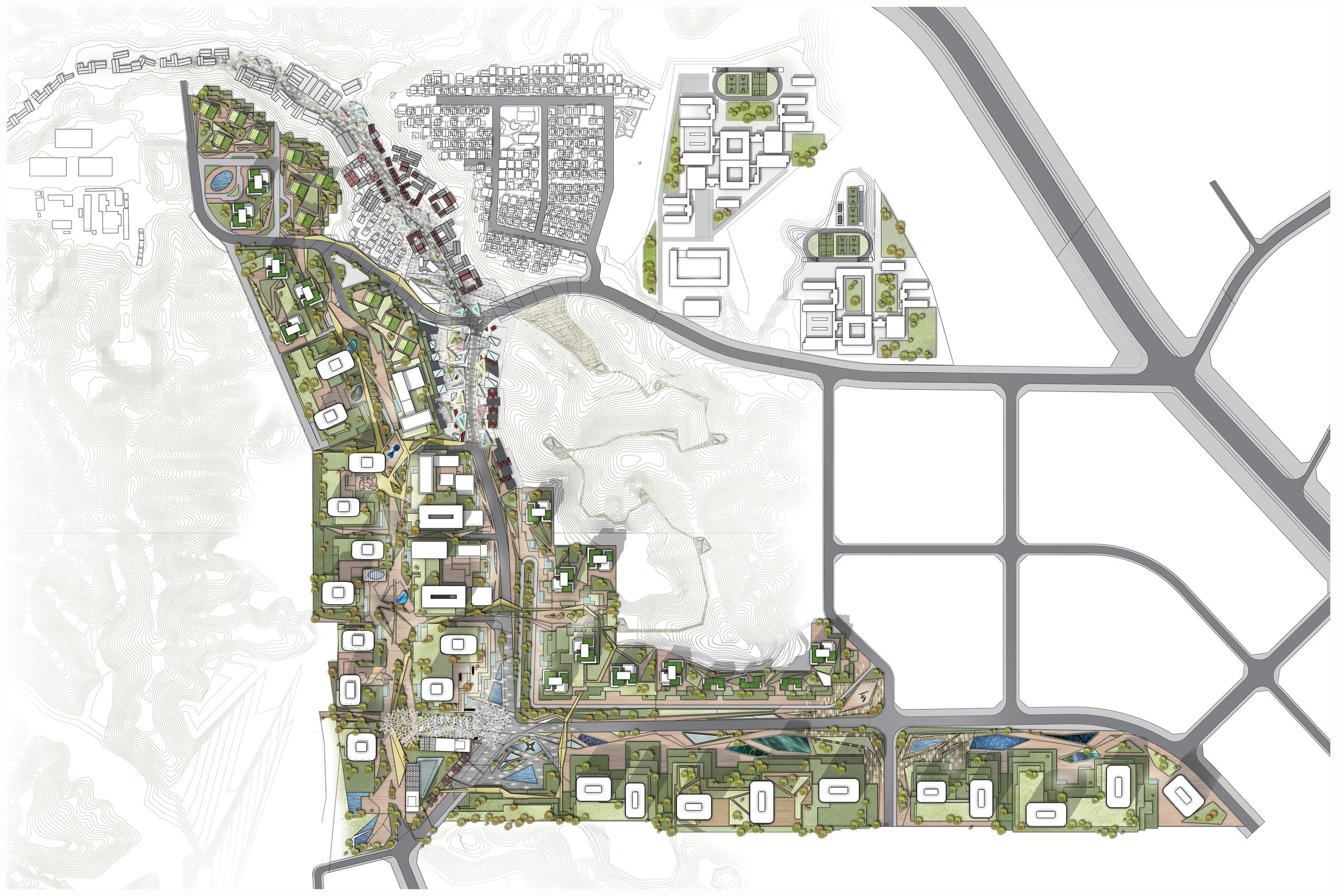
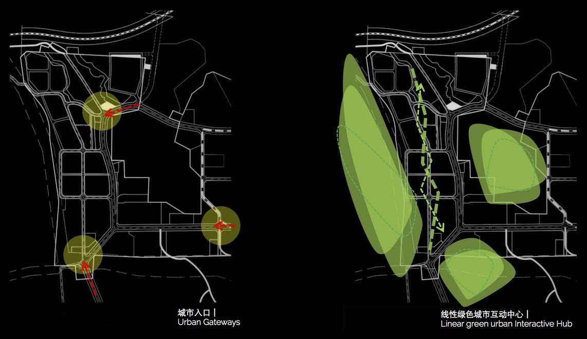
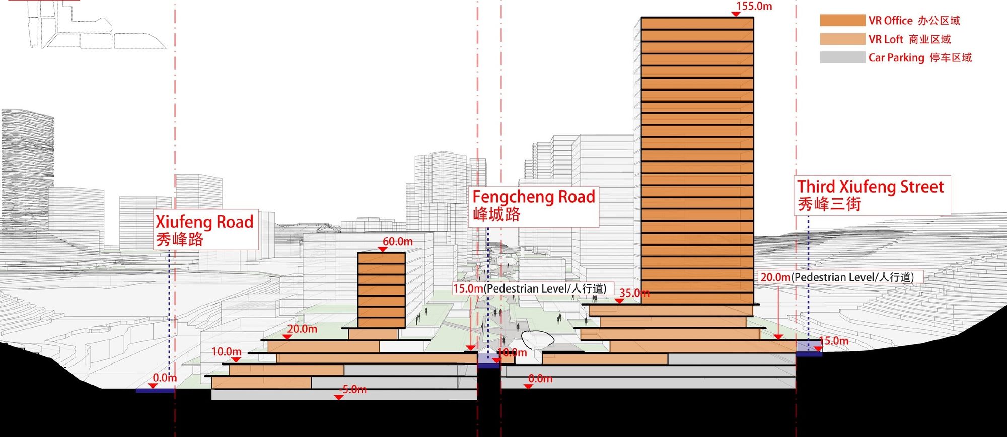
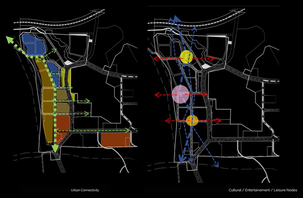
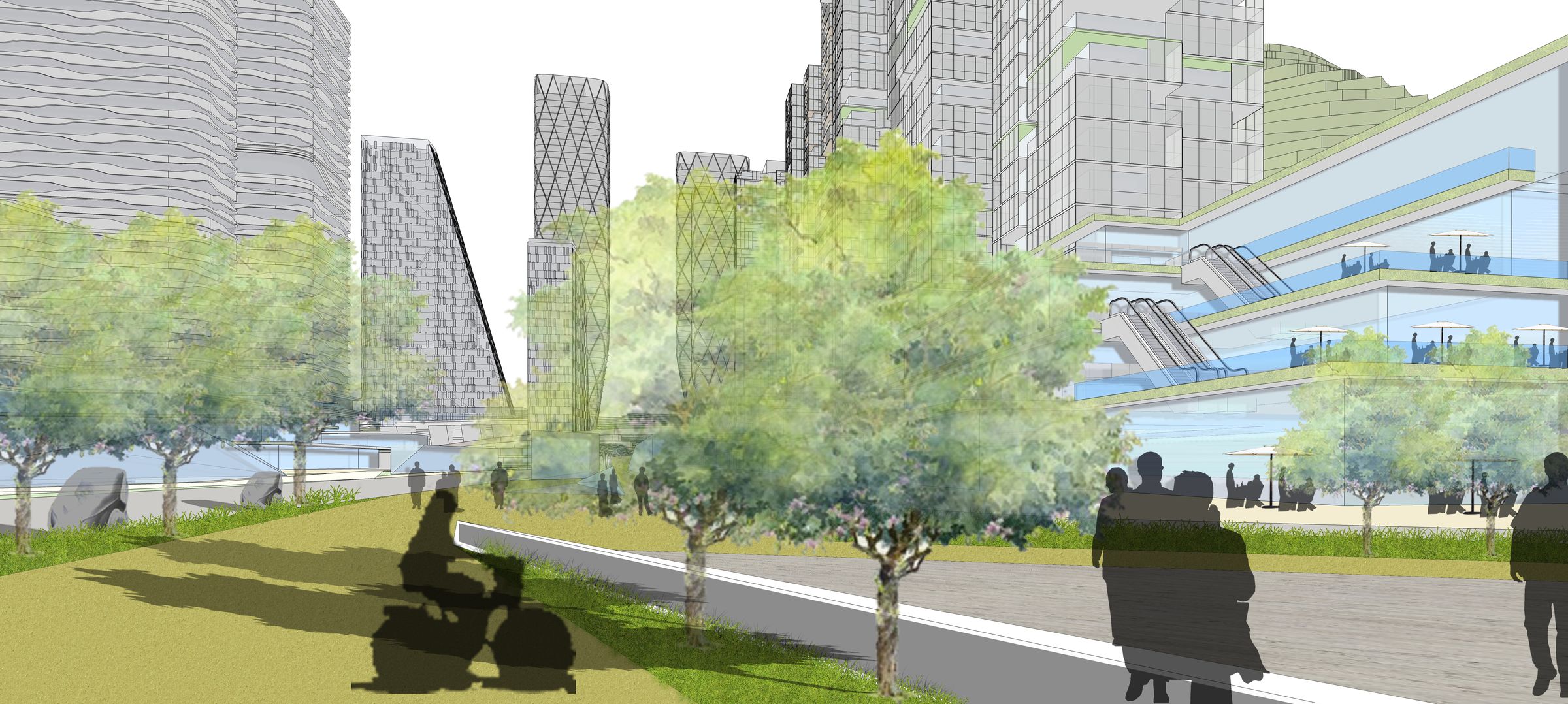
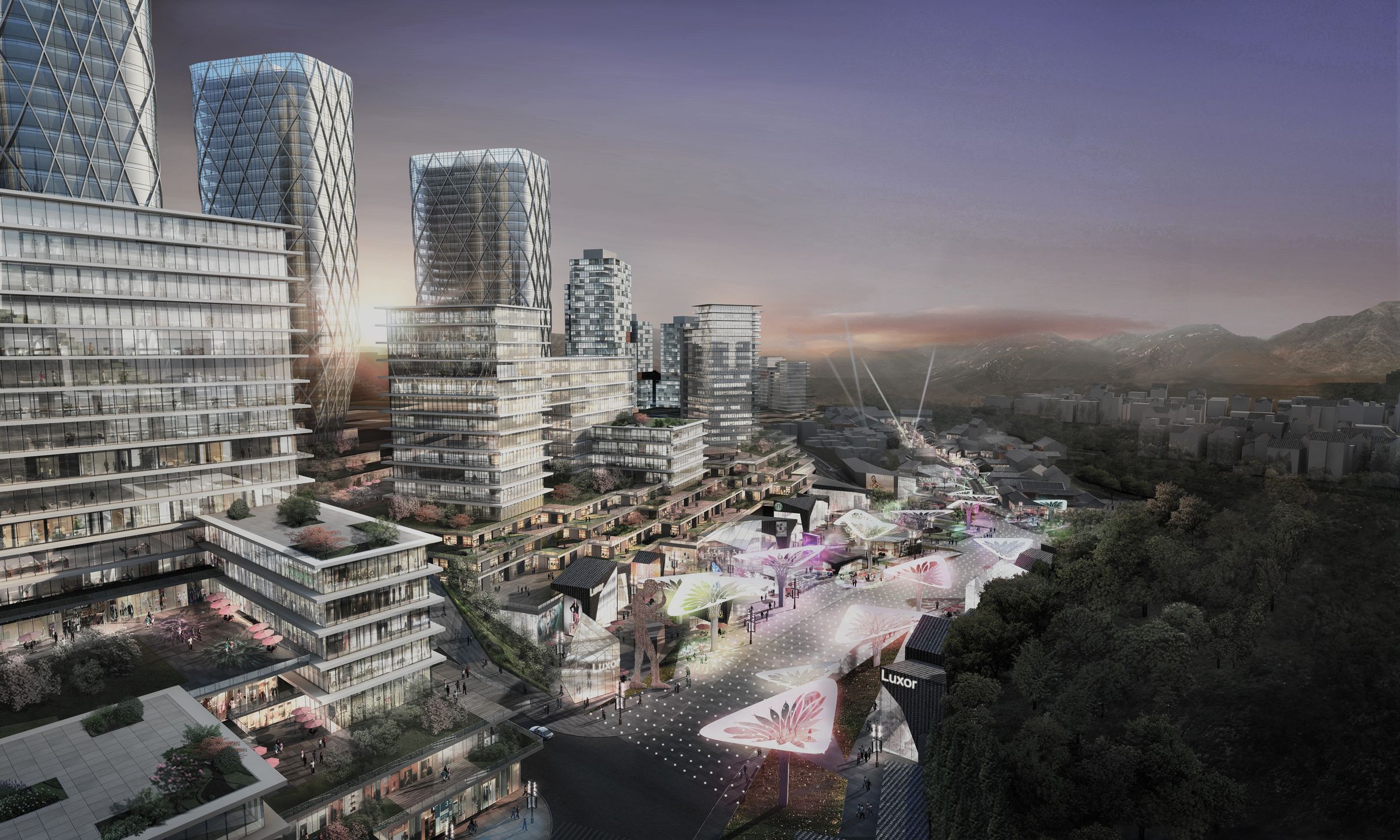
I set the towers along the western and southern edges, at the foot of the slopes, and let height step down toward the Hakka town. Between them, a green promenade and a boulevard run the length of the valley, about 1.2 kilometres from the new arrival plaza to the old town gate.
Roads drop beneath a terraced public realm. People walk fifteen to twenty metres above the traffic, at the level of shops, workplaces and gardens. Buildings along it set back 17 metres, so the promenade widens into gardens instead of narrowing into a corridor.
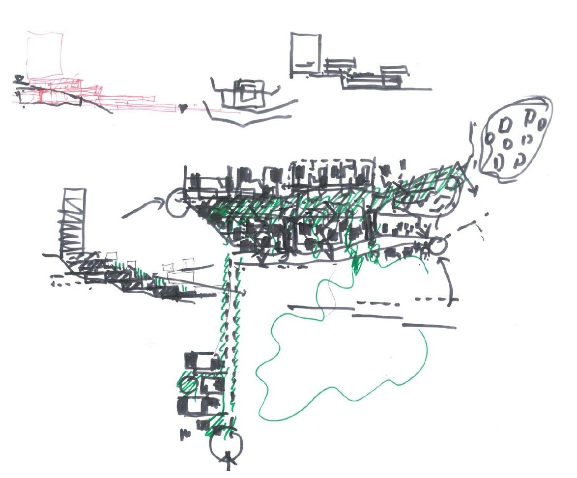
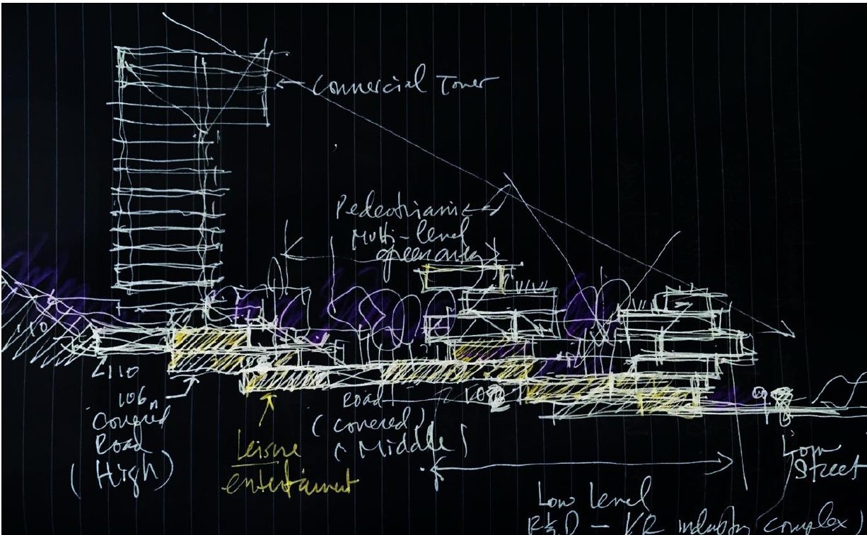
Sketches: Georges Hung.
How it works
- 01
A walk with a rhythm
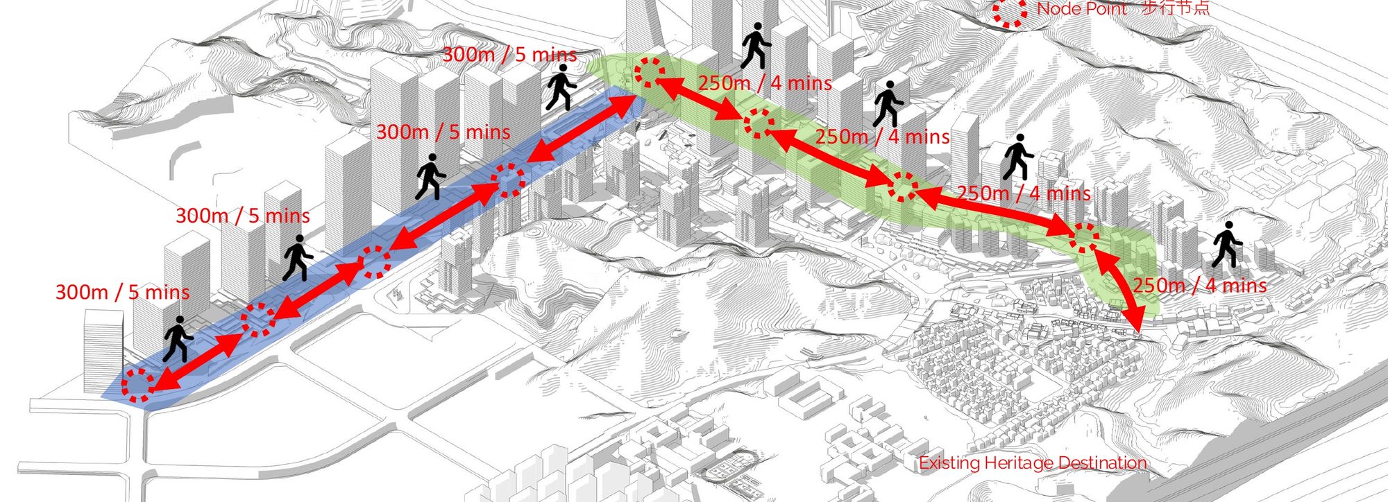
A public node every 250 to 300 metres, four to five minutes apart: a plaza, a view, a place to stop. The heritage town is under twenty minutes on foot from the new district.
- 02
Three plazas, three scales
Each is set by the ratio of building height to plaza width: 1:5, 1:1 and 1:2. One wide and open, one close like a room, one in between.
- 03
The hills as part of the route
The promenade joins a green loop and three trails — peak, urban and green — so the mountains become part of the daily walk, not a backdrop to it.
- 04
Three users, one street
The plan was organised around the entrepreneur on weekdays, the resident every day and the visitor at weekends, so the street stays alive all week.
- 05
Moving without cars
GPS-guided people-mover pods link the plazas, drop-offs and parking, so the promenade is left to people on foot.
- 06
Built in three phases
Housing, offices and the VR headquarters first, with new roads and underground parking. Then more industry and the landscape park. Then the second office stage, the main pedestrian street and more homes.
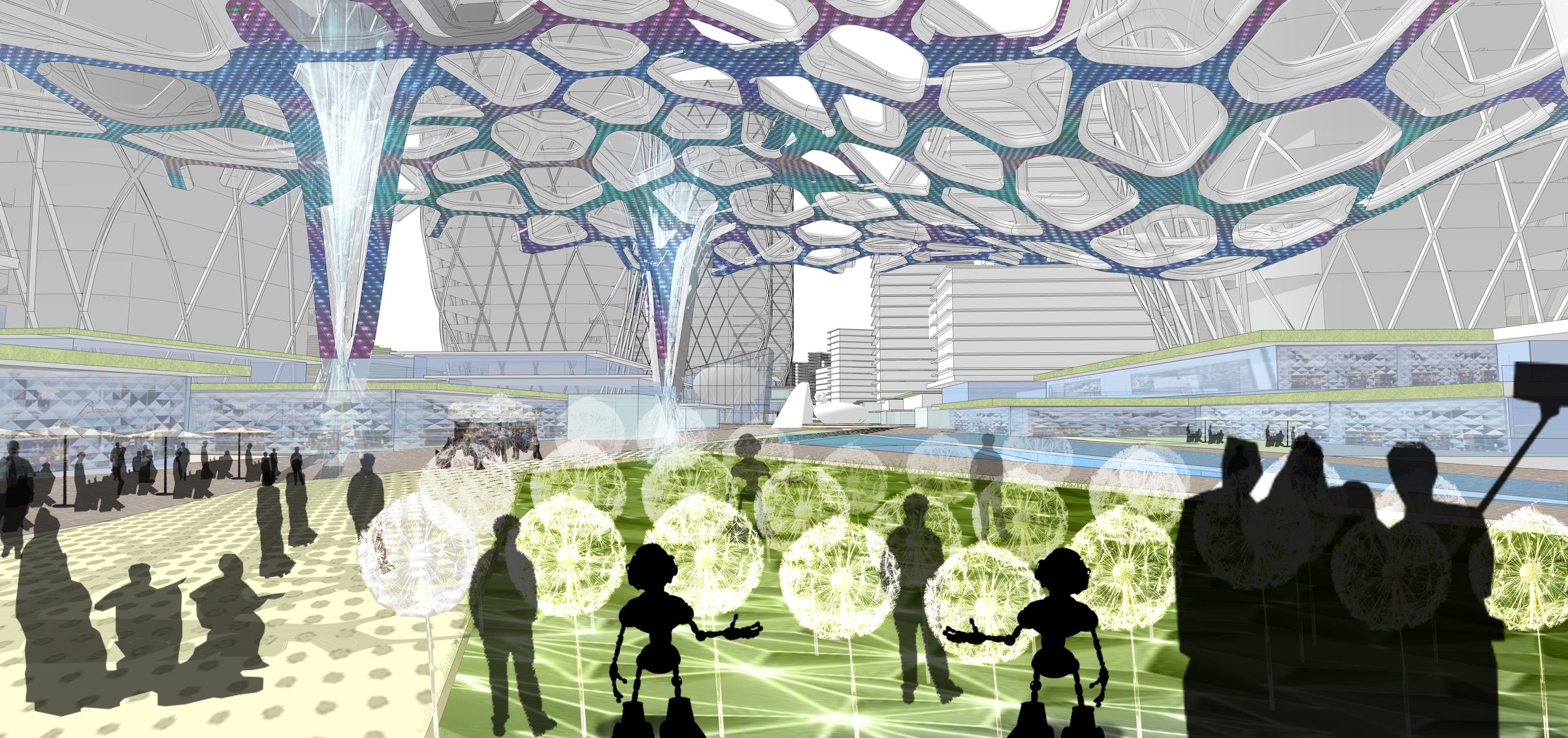
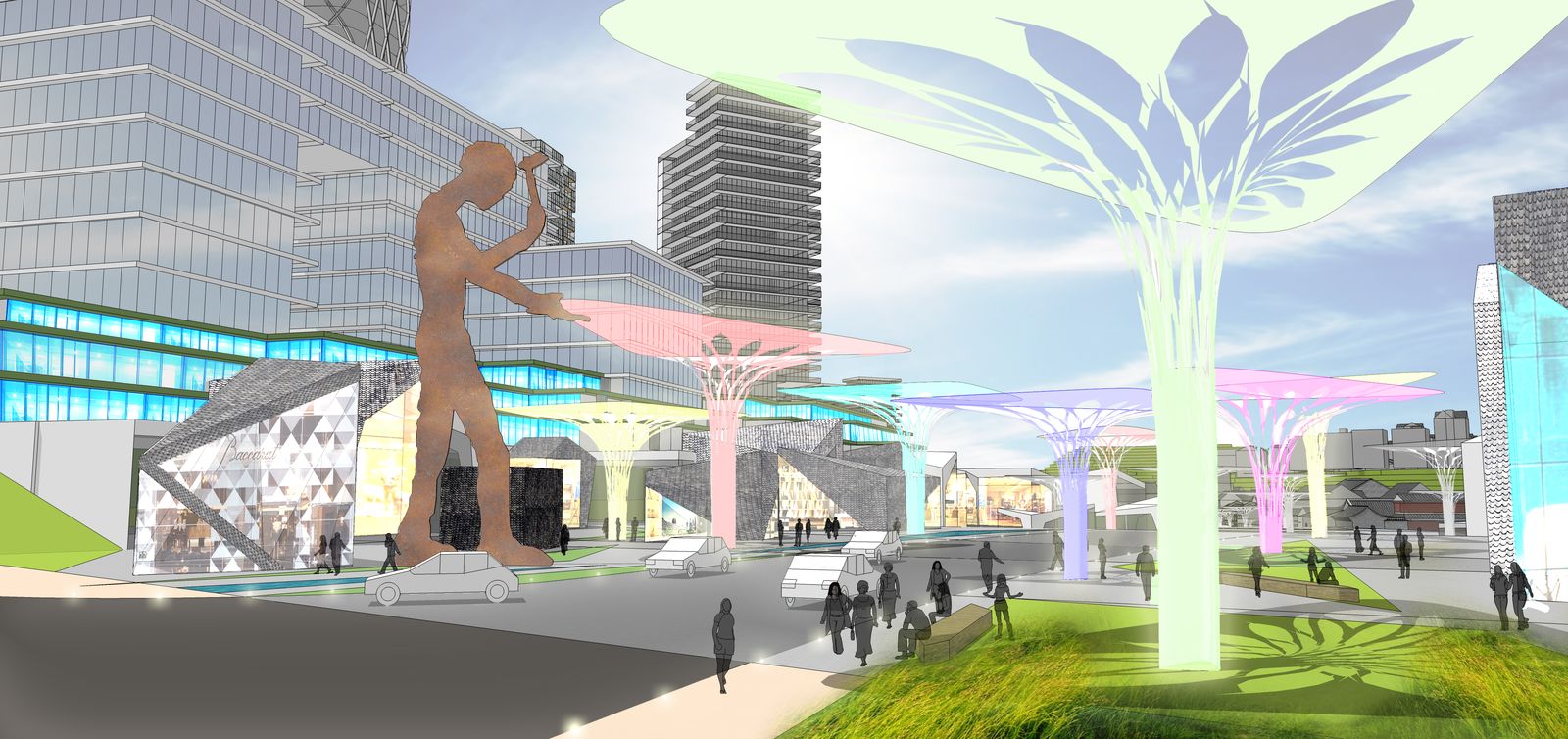
Three plazas
Each plaza marks a change in the walk, from the old town to the new. Their names say what they hold: memory, gathering and invention.
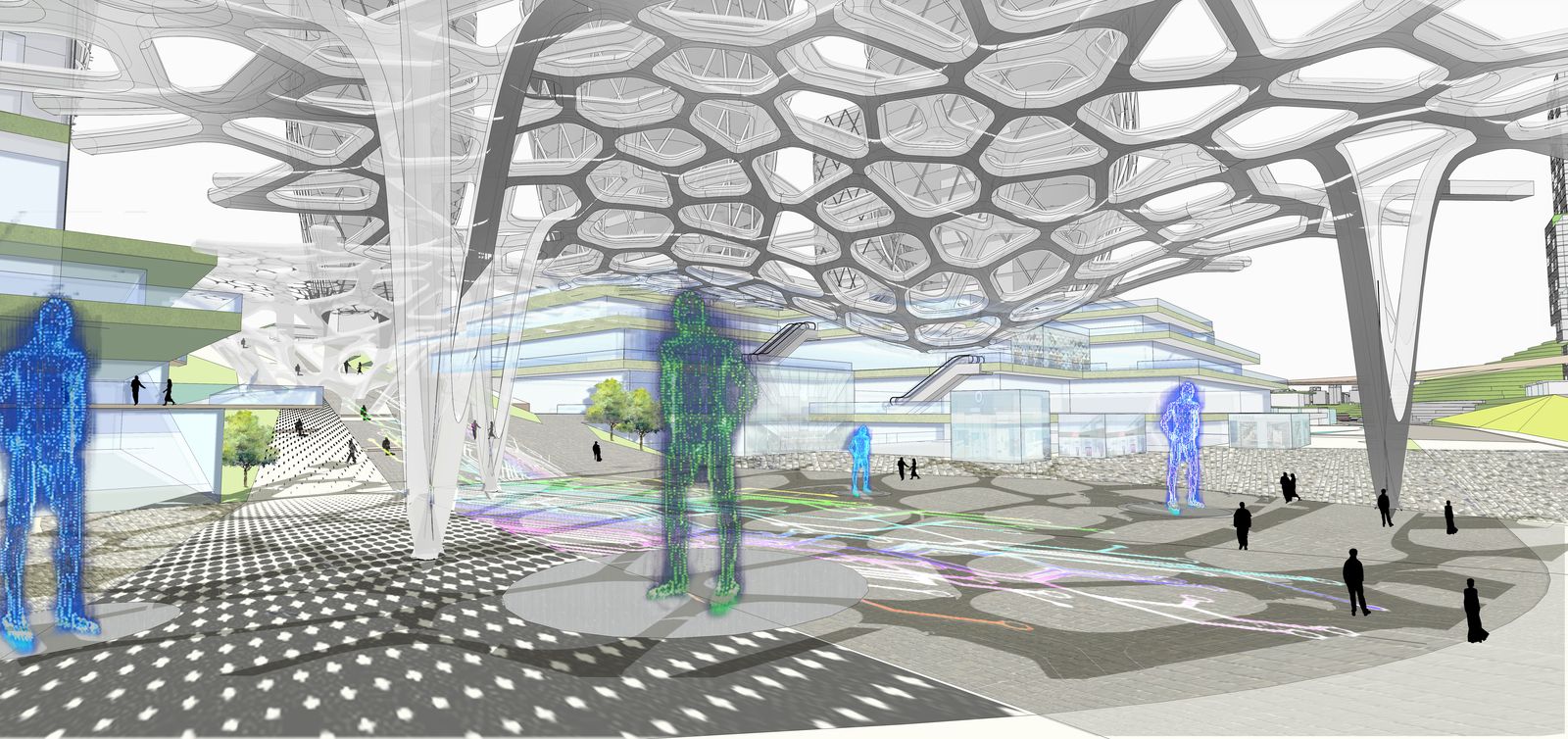
Design: Architecture Georges Hung. Image: Architecture Georges Hung.
- 28.7 ha
- study area across 13 plots, at the end of a mountain ridge, with hills rising 110 m around it.
- FAR 6.0–9.0
- plot by plot. Homes at 6.0, the VR headquarters at 9.0, the height held at the valley edge.
- 1.2 km
- green promenade and boulevard, from the new arrival plaza to the old town gate.
- 250–300 m
- between public nodes, four to five minutes on foot.
- 15–20 m
- above the roads: the level where people walk, shop and meet.
- < 20 min
- on foot from the new district to the Hakka town gate.
What it gave back
The study was presented to local planning officials. It widened the developer’s vision into a regional one: bring a new technology sector to this part of Shenzhen, and let it grow alongside the area’s heritage rather than over it. For the officials, it became a way to picture the next stage of urbanisation, with room for the next generation of technology, AI and robotics research.
Heritage was not a backdrop to the new district. It set the direction: the old town decided where the height could go, and where every walk would lead.